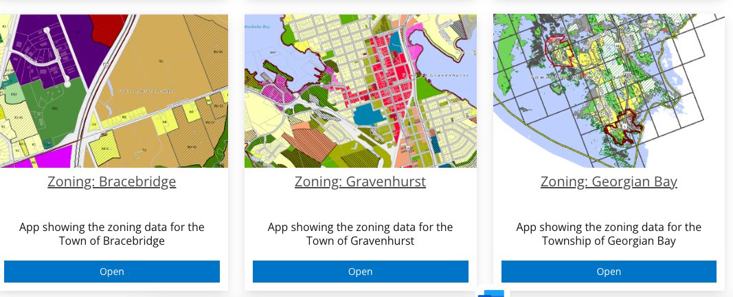
When talking about a zoning map, you’re referring to a map that shows how land in a certain area is designated for different uses by local government regulations. Zoning maps are essential for landowners, developers, real estate agents, and potential buyers to understand the potential and limitations of a property. Here’s what you can say about a zoning map:
Key Points About Zoning Maps:
-
Definition:
A zoning map is a visual representation of zoning ordinances within a particular jurisdiction. It outlines how different areas of land are used or intended to be used, typically categorized into residential, commercial, industrial, agricultural, and other zoning districts. -
Purpose:
-
Land Use Planning: Zoning maps help local governments manage land use and development, ensuring that the community’s needs for housing, business, and industry are met in an organized way.
-
Property Value Protection: Proper zoning can protect property values by preventing incompatible land uses (e.g., residential homes next to factories).
-
Building Restrictions: Zoning maps indicate what type of buildings can be constructed in specific areas, including height restrictions, setbacks, and density.
-
-
Types of Zones:
-
Residential (R): Land designated for housing, with subdivisions, apartments, or single-family homes allowed.
-
Commercial (C): Areas designated for retail, offices, restaurants, etc.
-
Industrial (I): Areas for manufacturing, warehouses, and other industrial uses.
-
Agricultural (A): Land intended for farming or agricultural activities.
-
Mixed-Use (MU): These areas can combine residential, commercial, and sometimes industrial uses.
-
-
Zoning Map Features:
-
Color Coding: Zoning maps often use different colors to represent various zones. For example, residential areas may be shown in yellow, commercial in blue, and industrial in red.
-
Legend/Key: A zoning map usually includes a legend or key that explains the different color codes and symbols used.
-
Boundaries and Districts: Zoning maps often show district boundaries, which may not always align with parcel boundaries, and these can be crucial when developing or subdividing land.
-
-
Importance for Development:
-
Before purchasing property or starting a development project, it is essential to check the zoning map to ensure the land is designated for the desired use.
-
Zoning maps can reveal whether a property is zoned for single-family homes, multi-family homes, or a specific business type, or if the zoning will need to be changed (through rezoning).
-
-
Rezoning:
-
Sometimes, landowners or developers may want to change the zoning of a property to allow for a different use (like changing from residential to commercial). This process is called rezoning, which often requires approval from local government bodies and public consultation.
-
-
Legal Considerations:
-
Zoning maps are legally binding, and properties must comply with the regulations set forth in the zoning district. Violating zoning laws can result in fines or forced changes to the property.
-
-
How to Access:
-
Zoning maps are typically available from local municipalities (town, city, or county offices). They can also be found online through municipal websites or real estate platforms. In Ontario, for example, municipalities like Gravenhurst, Huntsville, and Bracebridge have zoning maps available on their official websites.
-
-
Applications:
-
Real Estate: Understanding the zoning of a property helps real estate agents and potential buyers assess its potential for future development.
-
Permitting: Builders and contractors must adhere to the zoning map for building permits.
-
Land Use Decisions: Local governments use zoning maps to make decisions about urban development, infrastructure, and community services.
-
Key Takeaways:
-
Zoning maps are essential for understanding how land can be used and developed.
-
Proper zoning ensures that the community grows in an orderly fashion, with residential, commercial, and industrial areas properly separated.
-
Always consult a zoning map before buying or developing land to ensure it aligns with your intended use.


